

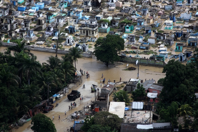
Caribbean and Central American countries are often exposed to the severe consequences of natural events. Besides wind and ground shaking, which are the primary effects of these events, secondary effects such as flooding, landslides, storm surge and wave impacts, and tsunamis also pose significant threat. Additionally, these countries are frequently affected by extreme precipitation events that are often, but not always, induced by tropical cyclones. The consequent losses are mostly caused by the accumulation of water over the land and, in the case of steep topography, by the high velocity of the water overflowing the land. These effects are further exacerbated by degraded ecosystems such as watersheds and forests.
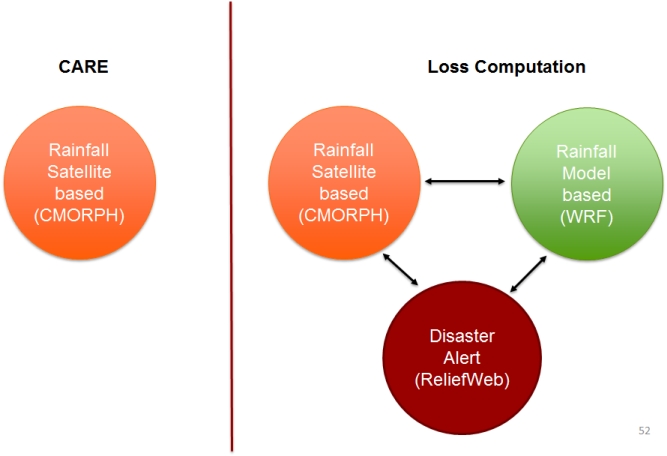
RED has recently developed an XSR Risk Model (XSR 2.0) to improve the accuracy of the near real-time rainfall estimates and to provide a simple excess rainfall policy structure. The XSR 2.0 Model is aimed at simulating in near real time the precipitation over a country and at rapidly estimating the potential consequent losses to public assets such that shortly after the end of the XSR event the country can receive a payout consistent with the insurance policy conditions when the country’s rainfall policy is triggered.
Unlike traditional parametric insurance products that are based only on event parameters, the XSR 2.0 model estimates rainfall-induced losses to the built environment. The XSR 2.0 model is a flexible tool that provides options for managing the identified XSR risk according to the financial needs of each country.
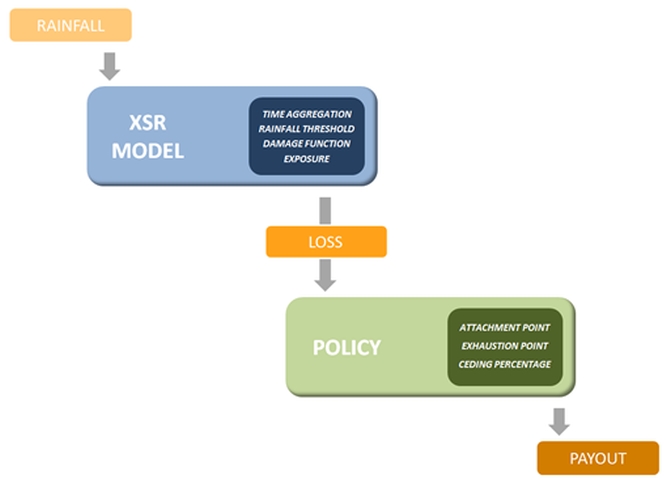
The XSR 2.0 Model is made up of the following modules:
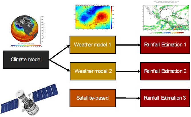
The hazard module provides on a daily basis estimates of the precipitation over a large domain that includes the Caribbean and the Central America regions. The daily estimates are derived in near-real time through a combination of climatic-meteorological models, which compute the amount of rainfall based on climate conditions, and of a low-orbiter satellite-based precipitation model. An XSR event is determined by the amount of average rainfall over a sufficiently large portion of the exposure fell during a country-specific accumulation period.
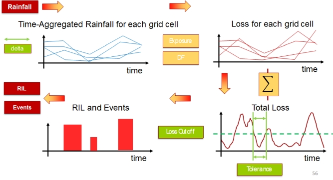
The exposure module utilizes several sources of data related to the built environment and to the surrounding topography. These datasets include national building census surveys, land use/land cover maps, nighttime lights, population censuses, Digital Elevation Maps (DEM), and satellite imagery among others. The final exposure database comprises information about the number of different types of structures, their area and their economic value. The exposure assets are grouped by structure classes of similar vulnerability to flooding. The database provides estimates of the asset count and replacement cost by structure class at a 30 arc second resolution (approximately 1x1 km2).
The vulnerability module is based on an archive of historical rainfall-induced regional losses, which provides useful information both on the severity and on the spatial and temporal distributions of such losses over the different countries. Based on this database, vulnerability analyses were carried out to identify the consequences to the built environment when an excess rainfall event occurs. The consequences of rainfall are modelled in mathematical terms by means of the so-called vulnerability functions, which are relationships that provide estimates of the losses caused by different amounts of precipitation to the assets affected.
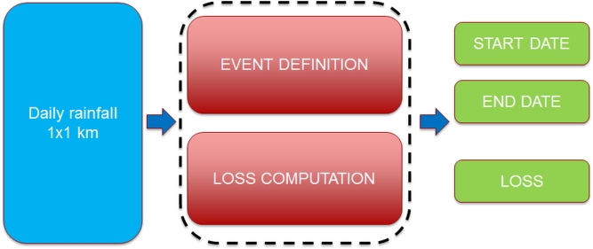
The loss module computes in near real-time after the XSR event has ended whether the precipitation estimated by the hazard module could potentially cause significant losses to the exposure assets that are located in the footprint of the event. Based on rainfall estimates, exposure values in the event footprint and vulnerability functions, the XSR model computes for significant events a synthetic loss index called the Rainfall Index Loss (RIL), which represents the modelled total loss due to the XSR event. The module is based on a different levels of triggers, which take into account both the rainfall and the consequent estimated losses.
The insurance module uses the model loss estimates to compute the payout to each country affected by an XSR Loss Event. The RIL is compared with the values of the Attachment Point (AP) and of the Exhaustion point (EP) of the policy and the payout is computed accordingly.
DISTINCTIVE FEATURES
Near real-time loss assessment for rapid insurance payments
Specifically-designed software
Multi-Trigger parametric structure, which reduces basis risk
DATE
2016
AMOUNT
Confidential
LOCATION
Caribbean and Central America
CLIENT
Confidential
SERVICES PROVIDED
Excess Rain Risk Model